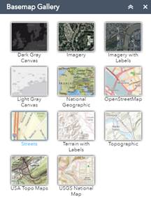
![]() Basemap
Basemap
Change the underlying base map.
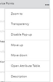
![]() Layers
Layers
Turn layers on and off
View symbology
Open Attribute Table
![]() Legend
Legend
Shows only the layers at the current zoom level.
![]() Draw
Draw
Drawing tools for quick sketches. Also ability to add measurements to the map. The drawings are temporary and mainly used for printing.
![]() Print Tool
Print Tool
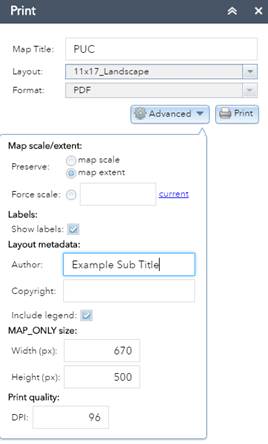
Export to various formats and layout sizes. Does not print directly to a
printer, a PDF can be created and then printed. Uses custom layouts created
for Princeton Public Utilites. Automatically adds a legend displaying only the
items in the current map. Fill in the “Author” value to add a sub title.
![]() Search- Service Point Address,
Electric or Water Meter IDs
Search- Service Point Address,
Electric or Water Meter IDs
Enter all or part of a service address, Electric Meter ID, or Water Meter ID. Abbreviations matter, if you search for Rum River Drive, but the service address has it listed as Rum River Dr, then it will show no results found.
![]() Edit Tool
Edit Tool
Add new features and update attributes.
![]() Service Points Batch Editor
Service Points Batch Editor
Select multiple service points all at once by drawing a polygon. Update voltage or inspection date for all selected points.
![]() Search address
Search address
Standard “out of the box” address search.
![]() Attribute Table (tab at bottom
of screen)
Attribute Table (tab at bottom
of screen)
View table for each layer.
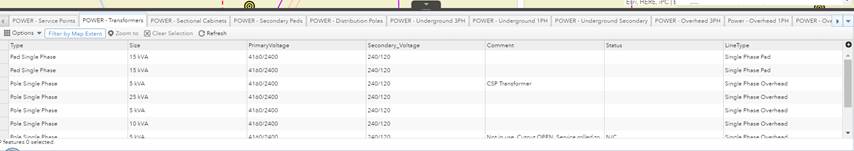
Filter by map extent or show all
![]()
Export to CSV (can open in Microsoft Excel)
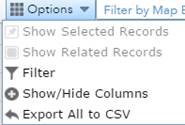
Filter- The filter will apply to the table AND the map until removed.
![]()